Subscribe:

Ads 468x60px

What Is Fog?

Fog
A fog is a cloud in contact with the ground. there is no basic difference between a fog and a cloud floating high in the atmosphere. When a cloud is near or on the surface of the earth or sea, it is simply called "FOG".

The commonest fogs are those seen at night and in the early morning over the lowlands and small bodies of water. They usually are caused by a cold current of air from above striking down upon the warmer surface of the land or water.

In the autumn they are very common, because the air is cooling faster day by day the land or the water. On still nights after dark, thin layers of fog often form close to the ground in low places. As the earth cools at night, the lower air gets cooler. where this cooler air meets the moist warmer air just above, fog forms.

As the general rule, city fogs are much thicker than country fogs. City air is full of dust and soot that mingle with tiny particles of water to form a thicker blanket.

Off the coast of Newfoundland, which is one of the foggiest parts of the world, fogs are formed by the passage of dump, warm air over the cold water flowing south from Arctic Circle, The chill of the water condenses the moisture of the air into tiny drops of water. These drops are not big enough to fall as rain. They remain in the air as fog.

San Francisco
fogs are formed in the opposite way. There a cool morning breeze blows over warm sand dunes, and if rain has moistened the sand the night before, a thick fog bank of evaporated moisture forms.

The reason fogs often seem denser than clouds is that the droplets are smaller in a fog. A large number of small drops absorb more light than a smaller number of large drops (as found in clouds), and thus it seems denser to us.

Why Does Iron Get Rusty?

rusty
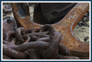
When you leave a piece of iron for a few days in a place it's damp or wet, a covering of rust forms over it just as if someone had come along and painted that reddish color on it.

What is rust? Why does it form in iron and steel? Rust is iron oxide. It is created when iron "burns" by uniting with oxygen dissolved in water.

This means that unless there is moisture in the air, or water is actually present, the oxygen is not dissolved in water and rust cannot begin to form.

When a drop of rain falls on a bright iron surface, the drop will remain clear for a short time. But the iron and the oxygen in the water soon begin to unite and form iron oxide, or rust, inside the drop. The drop will turn a reddish color and the rust is suspended in the water. When the drop evaporates, the rust will remain and form a reddish coat on the iron itself.
Once started, rust will spread even in dry air. This is because the rough spot of rust helps whatever moisture there is in the air to condense; it attracts the moisture and holds it. That's why it's easier to prevent rust from starting than to prevent it from spreading once it has started.

Since iron and steel articles often have to be stored for long periods of time, the problem of preventing rust is an important one. Sometimes such articles are coated with a special paint or plastic film. But what would you do if you had keep the insides of battleships rust-free when these ships are not in use? Govt. has solved it by using dehumidifiers. These are machines that draw moist air out of the compartments of the ship and replace it with dry air. Rust never gets a chance to start!

What is Humidity?

If you put a pitcher of ice water on a table and left it stands a while, what happens? Moisture gathers on the outside of the pitcher. Where does this moisture come from? It comes from the air.

The fact is there is always moisture in the air in the form of water vapor. In the case of the ice pitcher, the vapor condensed on the cold surface of the pitcher and thus became visible. But water vapor in the air is invisible. And the word “humidity” simply means the presence of water vapor in the air. It is found everywhere, even over great deserts.

This means, of course, that we always have humidity, but the humidity is not always the same. We have several ways of expressing the humidity, and two of them are “absolute humidity’ and humidity.” Let’s see what each means.

“Absolute humidity” is the quantity of water vapor in each unit volume of air. There are so many grains per cubic foot of air. But for most practical purposes, this doesn’t tell us very much. If you want to know whether you’ll feel comfortable or not, the answer “four grains per cubic foot” won’t tell you whether the air will feel dry or humid. The more easily moisture from your body can evaporate into the air, the more comfortable you’ll be. The evaporate power doesn’t indicate anything about the evaporate power of the air.

Relative humidity is expressed as a percentage. “One hundred per cent” stands for air which is saturated or completely filled with water vapor. The higher the temperature, the greater the quantity of water vapor air can hold. Thus, on a hot day, a “90 per cent relative humidity” means an awful lot of moisture in the air- a day that will make you mighty uncomfortable.

Where Does The Wind Come From?

There are two ways of looking at the wind and where it comes from. One is in terms of your immediate neighborhood, and one is in terms of the world and the big winds that blow over it.

Differences in pressure may exist in a small region around you, and you will have a local wind blowing. Of you live near the shore, you have an example of this every day. During the day, the land becomes heated, the air above it rises, and cool winds come in from the water to take its place. At night, the land becomes colder that the water, the warm air rises over the water, and the breeze blows out from the land to take the place of the rising warm air.

What is true in our immediate neighborhood is true on a much larger scale of the winds that blow over the earth. The warmest place on earth is around the Equator. So there is always a belt of warm air rising from this region. This belt of warm air flows out to the north and south and sinks again at certain latitudes, which are called “the horse latitudes.” This sinking air flows out along the surface of the earth toward the Equator and the Poles.

If the earth were not rotating, these winds would be north winds or south winds. But the spinning of the earth makes all winds in the Northern Hemisphere deflect to the right and in the Southern Hemisphere to the left. The winds blowing from the horse latitudes toward the Equator are called “the trade winds.” Those blowing toward the Poles are called “the westerlies.” The United States is largely in the zone of the westerlies.

There are other “prevailing” or common winds in other parts of the worlds. But as you can see, the wind does come from somewhere- and it comes from there because of every definite reasons caused by the way air over the earth is heated.

What Is The Jet Stream?


Nowadays, the word “jet” is very much in the news, and you might imagine that all the “jet stream” has something to do with jet planes. This isn’t the case at all!

The jet stream is part of the system of winds that surround the earth, so let’s start with the subject of winds. Winds are currents of air that move parallel to the surface of the earth and close to it.

The movement of winds is chiefly caused by the existence of areas of different pressure, and winds always blow from areas of high pressure to areas of low pressure.

If we look at it from an over-all point of view (not from local regions) we can say that, in general, cold air is transported from the Poles toward the Equator, and warm air from the Equator towards the Poles. This flow doesn’t take place in smooth currents, but forms a system of rather turbulent streams. There are various conditions that decide what happens in each specific region. There may be local sources of heat which affect the pressure. The way the land and water and mountains are distributed can decide which way the local winds blow.

Finally, there is the existence of semi-permanent high-pressure areas in certain places. This means that in these regions there tends t be a high-pressure area most of the time. They are called “anticyclones” and wind currents locally are decided by them.

Now, this gives you a general idea of how winds blow and some of the things affect them. But all of this concerns winds that are quite close to the earth, in the lower layers of the atmosphere. As you know, the earth is surrounded by atmosphere that may go as high as 1,500 miles up. In the higher levels of the atmosphere, different wind conditions exist. Here they usually move with much greater speed than near the surface. At a height of about 30,000 feet, currents of air move with such speed that they a special name- “the jet stream”! The speed of the jet stream ranges from 100 to 200 miles per hour.

Why Do We Have Different Seasons?

Since earliest times, man has been curious about the changing of the seasons. Why is it warm in summer and cold in winter? Why do the days gradually grow longer in the spring? Why are the nights so long in winter?

We all know the earth resolves around the sun, and at the same time it revolves on its own axis. As it moves around the sun, it’s also spinning like a top. Now if the axis of the earth (the line from the North Pole through the South Pole) were at right angles to the path of the earth around the sun, we would have no such things as different seasons, and all the days of the year would be of equal length.

But the axis of the earth is tilted. The reason for this is that a combination of forces is at work on the earth. One is the pull of the sun, the other is the pull of the moon; the third is the spinning action of the earth itself. The result is that the earth goes around the sun in a tilted position. It keeps that same position all year, so that the earth’s axis always points in the same direction, toward the North Star.

This means that during part of the year the North Pole tilts toward the sun and part of the year way form it. Because of this tilt, the direct rays of the sun sometimes fall on the earth north of the Equator, sometimes directly on the Equator, and sometimes south of the equator. These differences in the way the direct rays of the sun strike the earth because the different seasons in different parts of the world.

When the Northern Hemisphere is turned toward the sun, the countries north of the equator have their summer season, and the countries south of the Equator have their winter season. When the direct rays of the sun fall on the Southern Hemisphere, it is their summer and it is winter in the Northern Hemisphere. The longest and shortest days of each year are called “the summer solstice’ and “winter solstice.”

There are two days in the year when night and day are equal all over the world. They come in the spring and fall, just halfway between the solstices. One is the autumnal equinox, which occurs about September 23, and the other is spring equinox, which occurs about March 21.

How Does The Weatherman Know What To Say?


All the conditions of the atmosphere are “weather.” Whether it’s hot or cold, dry or wet, sunny or cloudy, windy or still, it’s “weather.” The weather is changeable from day to day, and the total effect during a year is called “the climate.”

There are many complicated reasons for changes in the weather, but the most important influence is the sun. The sun’s heat evaporates water and warms the air, so that rising currents of warm air carry water vapor into the sky. There the air cools and the vapor condense into rain. These things happen gently or violently. When they take place violently, we have storms.

In Great Britain there are approximately 200 weather reporting stations and roughly the same number spread over the rest of Europe. In addition, “weather ships” stationed in the Atlantic and special aircraft on regular patrol send back systematic reports on weather conditions. From this and other meteorolical data weather forecasts are produced.

The maps which the weather experts study show them many things: places where the air pressure is equal, places of equal temperature, directions of local winds, cloudy or clear skies, rain or snow, the amount rainfall, and regions where the air pressure is higher or lower than normal.

The weatherman can also tell from looking at the map what is likely to happen under the conditions that exist. He knows that low pressure indicate storms, because cold air is moving in to replace warm rising air that is laden with moisture. High pressures indicate fair weather.

In the Northern Hemisphere, the winds around a high-pressure area blow outward in a direction similar to that followed by the hands of a clock.
In a low-pressure area they blow inward in a counterclockwise direction. Thus the directions the winds will take can be predicted. The weatherman also knows how fast these pressure areas are moving across the country.

Knowing all these things, and having reports of the weather in most parts of the country before him, the weatherman begins to get a pretty good idea of what to say about the weather that’s coming to your area!

Where Do Most Earthquakes Occur?

If you could look at a map that showed the entire surface of the earth and where earthquakes occur most often, you’d see a wavy ribbon that twisted up and down as it twisted around the earth. Some parts are missed entirely; others seem to have a habit of having frequent earthquakes.

The single reason of the earth that has the most frequent earthquakes is Japan. There is an earthquake there almost every day of the year! Of course, most of these are very minor quakes and do no damage at all. Another region which has frequent earthquakes is the Mediterranean area. By contrast, consider the New England States. There have been no destructive earthquakes there since the Ice Age, many thousands of years ago!

The explanation for this is that the crust of the earth is not the same everywhere. In certain regions, the crust has not quite settled down firmly, and there is a “fault.” A fault is a break in the rocks of the earth’s crust. Where the break exists, one rock mass rubs against another with great force and friction. The energy of this rubbing is changed to vibration in the rocks.

While this vibration may travel thousands of miles, the earthquake is strongest, as you might imagine, right along the line of the fault made by the shifting of the earth blocks. The sides of the fault may move up and down against each other, or the sides of the fault may shift lengthwise.

Most of the changes that take place on the surface of the earth after an earthquake are seen along this fault line. The part of the fault line where the vibration is felt most strongly is called “the epicenter” of the earthquake. And if this is near a city, the destruction may be very great. The loss of life is usually due to falling buildings and fires that may be started by broken gas mains under streets.

The earthquake regions of the earth and the areas of recent volcanic activity are roughly the same. This is because both of these are regions where the earth’s crust is not at rest.

Why Do Volcanoes Appear only In Certain Places?


There are no volcanoes near New York City or London or Paris-nor are there likely to be any in the future. Yet there are parts of the world where there are several volcanoes quite near each other.

Central America, bordering the Pacific Ocean, is one of the most active volcano areas of the world. In fact, more than two-thirds of the active volcanoes and a large number of those which have been extinct for only a short time are found around the borders of the Pacific Ocean!

The reason is simply this: The earth’s crust in these areas must be “weak” or have weak spots in relation to the earth’s crust in other parts of the world. For without a weak spot in the crust of the earth, a volcano couldn’t come into being.

Here is how a volcano is born: As you know, the center of the earth is hot. The deeper you go under the surface of the earth, the higher the temperature. At a depth of about 20 miles, it is so hot (1,000 to 1,100 degrees centigrade) that most rocks found there simply melt.

When rock melts, it expands and needs more space. In certain areas of the worlds, new mountain ranges have recently been formed (new in terms of thousands of year). Under and near these new mountain ranges, the pressure is less than elsewhere. It is a kind of “weak spot”
in the earth’s solid crust.

So the molten rock, which is called “magma,” expands into these parts and a local reservoir of the molten rock is formed. This material rises along the cracks formed by the uplift. When the pressure in the reservoir of molten rock becomes greater than the strength of the roof over it, it bursts forth as a volcano. The eruption lasts until the gas is gone.

The material that comes out of a volcano is mainly gaseous, but large quantities of molten rock (which we call “lava”) and solid particles that look like cinders and ash are also thrown out. The eruption is really a gas explosion, but some of the lava becomes finely powered and makes the eruption look like black smoke.

Why Do We Still Have Glaciers Today?


The great ice mass that began the Ice Age in North America has been called “a continental glacier; it may have been about 15,000 feet thick in its center. This great glacier probably formed and then melted away at least four times during the Ice Age.

The Ice Age or glacial period that took place in other parts of the world still has not had a chance to melt away! For instance, the big island of Greenland is still covered with a continental glacier, except for a narrow fringe around its edge. In the interior, this glacier often reaches heights of more than 10,000 feet. Antarctica is also covered by a vast continental glacier which is 10,000 to 12,000 feet high in places!

So the reason we still have glaciers in certain parts of the world is that they have not had a chance to melt away since the Ice Age. But most of the glaciers that exist today have been formed in recent times. These glaciers are usually the valley type of glacier.

It starts in a broad, steep-walled valley shaped like a great amphitheater. Snow is blown into this area or sliders in from avalanches from the slopes above. This snow doesn’t melt during the summer but gets deeper year by year. Eventually, the increasing pressure from above, together with some melting and refreezing, forces the air out of the lower part of the mass and changes it into solid ice. Further pressure from the weight of ice and snow above eventually squeezes this mass of ice until it begins to creep slowly down the valley. This moving tongue of ice is the valley glacier.

There are more than 1,200 such glaciers in the Alps of Europe! Glaciers are also found in the Pyrenees, Carpathian, and Caucasus Mountains of Europe, and in southern Asia. In Southern Alaska, there are tens of thousands of such glaciers, some from 25 to 50 miles long!

When Did The Ice Age End?

Most people think of the Ice Age as something that happened so long ago that not a sign of it remains. But did you know that geologists say we are just now reaching the end of the Ice Age? And people who live in Greenland are actually still in the Ice Age as far as they’re concerned.

About 25,000 years ago, any people who may have been living in central North America saw ice and snow the year round. There was a great wall of ice that stretched from coast to coast, and the ice extended northward without an end. This was the latest Ice Age, and all of Canada, much of the United States, and most of northwestern Europe were covered by a sheet of ice thousands of feet thick.

This didn’t mean that it was always icy cold. The temperature was only about 10 degrees lower than it is now in Northern United States. What caused the Ice Age was that the summers were very cool. So there wasn’t enough heat during the summer months to melt away the winters ice and snow. It just continued to pile up until it covered all the northern area.

But the Ice Age really consisted of four periods. During each period the ice formed and advanced, then melted back toward the North Pole. It is believed this happened four times. The cold periods are called “glaciations,” and the warm periods are called “interglacial” periods.

It is believed that in North America the first period of ice came about 2,000,000 years ago, the second about 1,250,000 years ago, the third about 5,00,000 years ago, and the last about 100,000 years ago.

The last Ice Age didn’t melt at the same rate everywhere. For example, ice that reached what is now Wisconsin began to melt about 40,000 years ago. But ice that had covered New England melted about 28,000 years ago. And there was ice covering what is now Minnesota until about 15,000 years ago!

In Europe, Germany got from under the ice 17,000 years ago and Sweden remained covered with ice until about 13,000 years ago!

How Are Icebergs Formed?

We may think of icebergs as exciting and interesting things to see, but they are a great danger to ocean vessels when they drift into shipping routes. One of the greatest disasters at sea took place when the Titanic struck an iceberg on the night of April 14, 1912, and 1,513 people lost their lives.

An iceberg is a piece of glacier that has broken off. This happens where the glaciers (which are like rivers of ice) push down valleys until they reach the sea. The end of the glacier breaks off there and forms a floating iceberg.

Some glaciers do not reach the open sea but end in deep, steep-sided valleys called “fiords.” The icebergs float down to the ocean from these fiords. In the case of some glaciers, the ends are worn or melted back by the waves. This leaves a big “foot” of ice submerged below the surface of the water. Such ice feet break off from time to time and rise suddenly to the surface as icebergs.

Icebergs vary greatly is size. Small ones up to 20 or 30 feet across are often called “growlers” by seamen. But icebergs which measure hundreds of feet are very common, and there have been some giant bergs seen that measured as much as half a mile across.

The ice in icebergs is only eight-ninths as heavy as sea water, so that only one-ninth of the iceberg sticks out above sea level and eight-ninths is below where it can’t be seen. So a berg which rises 150 feet above the sea may extend 1,000 feet below! The amount of ice in an iceberg is almost unbelievable. Did you know that many of them weigh as much as 2,00,000,000 tons?

Because icebergs extend so far below the surface of the ocean, they don’t drift with the winds but instead follow the ocean currents. Eventually most icebergs are carried to lower warmer latitudes where they melt. Very few of them last long after they meet the warm Gulf Stream east of Newfoundland, Canada. But those that do become a menace to ships. That’s why the United States Coast Guard maintains an iceberg patrol there to warn ships of the location of iceberg.

What Are Fossils?


The study of fossils is so important in helping man learn about his own past and that of animals who lived millions of years ago that it has developed into a separate science called “paleontology.”

Fossils are not, as same people think, the remains of bodies buried ages ago. Actually, there are three different kinds of fossils. The first is part of the actual body of the organism, which has been preserved from decay, and which appears just as it was originally. But fossils may also be just the cast or mold of the shape of the body, which remains after the body of the plant or animal, has been removed. And fossils may merely be the footprints or trails that animals have left as they moved over the soft mud or clays.

When a fossil is found that consists of part of the organism itself, it is usually only the hard parts, such as shells or skeletons that are preserved. The softer parts are destroyed by decay. Yet, in some cases, even such soft-bodied animals as jellyfish, which are 99 per cent water, have left perfect fossils of themselves in rocks! And certain fossils found encased in ice not only have the skeleton preserved but also the flesh and skin on the bones.

Fossils have nothing to do with size. For instance, the fossils of tiny ants which lived millions of years ago can be found perfectly preserved in amber. The chances for animals being preserved as fossils depend mostly on where they lived. The most numerous of all fossils are water animals because when they die their bodies are quickly covered over by mud and so kept from decaying. Land animals and plants are exposed to the destroying action of the air and weather.

It is chiefly through the study of fossils that we know about animal life as it existed millions and hundreds of millions years ago. For example, fossils taken from certain rocks tell us that millions of years ago there was an Age of Reptiles, with monsters so huge that they were 80 feet long and weighed 40 tons. These were the dinosaurs. And our entire knowledge about the earliest bird, called “the archeopteryx,” is based on just two fossils of it that have been found!

How Are Caves Formed?


Caves have long been linked with the history of man in many interesting ways. We know that late on the Old Stone Age, caves were the winter dwelling place of people who had no other shelter.

But long after man stopped using caves as homes, ancient people believed many strange things about caves. The Greeks believed caves were the temples of their gods, Zeus, pan, Dionysus, and Pluto. The Romans thought that caves were the homes of nymphs and sibyls. The ancient Persians and others associated caves with the worship of Mithras, chief of the earth spirits.
Today, huge and beautiful caves all over the world are tourist attractions. Caves are deep hollow places in the rocky sides of hills or cliffs. Large caves are called “caverns.”

Caves are formed in many different ways. Many caves have been hollowed out by the constant beating of the sea waves against the rocks. Some caves appear under the surface of the earth. These are usually the old courses of underground streams which have worn away layers of soft rock such as limestone. Others are formed by the volcanic shifting of surface rocks, or by the eruption of hot lava.

The most common type of cave in the United States is that made by the wearing a way of thick layers of limestone. This is done by the action of water containing carbon dioxide. In Indiana, Kentucky, and Tennessee, where there are great beds of limestone with an average thickness of 175 feet, such caves are numerous.

Some caves have openings through their roofs, called “sink holes.” These formed where the surface water first gathered and seeped down. Some caves have galleries in tiers or rows, one above another. Underground streams wind through some caves, through in many cases after a cave has been formed, the streams that once flowed through it may find a lower level and leave the cave dry.

In many cases, each drop of water that drips from a cave roof contains a bit of line or other mineral matter. As part of the water evaporates, some of this matter is left behind. It gradually forms a stalactite, shaped like an icicle hanging from the roof. Water dripping from the stalactite to the floor builds up a column called “a stalagmite.”

Why Are There So Many Different Kinds Of Rocks?

Is there any boy anywhere in the world who hasn’t filled up his pockets at some time with all kinds of strange rocks? The different sizes and shapes, some rough and some smooth, the different colors, some almost like precious gems, just made up want to collect them!

What makes rocks look so fascinating is the fact that they are composed of one or more minerals? It is these minerals which often give different rocks their wonderful colors, or make them sparkle like gems.

All rocks aren’t formed in the same way. One kind of rock, called “sedimentary rock,” has been formed by sediment. This means that substances were laid down long ago by water, wind, ice, or by the work of plants and animals. Since they are laid down in layers which are called “strata,” these rocks are called “stratified” rocks. The tiny particles of which such rocks are made are usually rounded, since the sharp edges and corners have been worn off while the particles were being rolled along stream beds, washed by the waves, or blown by winds. Sandstones and limestone’s are typical sedimentary rocks.

Other rocks were once molten matter deep in the earth. They have been poured out on the surface or forced into cracks in other rocks. Such rocks are called “igneous” rocks, and examples of this type are granite and basalt.

The third kind of rocks was once in some other form (igneous or sedimentary), but has been changed into its present form by heat or pressure. This type is called “metamorphic” rock, and marble and quartzite are examples of this type.

In some rocks, different metal-bearing minerals are found mixed with the other rock substances. If there is enough of the metal to make it worthwhile separating it, the rock containing it is called an “ore.”

How Were The Mountains Made?


Because mountains are so big and grand, man thinks of them as unchanging and everlasting. But geologists, the scientists who study mountains, can prove that mountains do change, and that they are not everlasting.

Certain changes in the earth’s surface produced the mountains, and they are constantly being destroyed and changed. Boulders are broken from mountainsides by freezing water; soil and rock particles are carried away by rain-wash and streams. In time, even the highest mountains are changed to rolling hills or plains.

Geologists divide mountains into four classifications, according to how they were formed. All mountains, however, are the result of violent changes in the earth’s surface, most of which happened millions of ten years ago.

Folded mountains were made of rock layers, squeezed by great pressure into large folds. In many places in such mountains, you can see the rock layers curving up and down in arches and lips, caused by the squeezing and pressure on the earth’s surface. The Appalachian Mountains and the Alps of Europe are examples of folded mountains.

In Dome Mountains, the rock layers were forced up to make great blister-like domes. In many cases, molten lava coming with great pressure from below the earth’s surface lifted these rock layers. The Black Hills of South Dakota are examples of Dome Mountains.

Block Mountains are the result of breaks, or faults, in the earth’s crust. Huge parts of the earth’s surface, entire “blocks” of rock, were raised up or tilted at one time. The Sierra Nevada Range of California is a block that is 400 miles long and 80 miles wide!

Volcanic mountains are built of lava, ash, and cinders poured out from within the earth. The usual volcano is cone-shaped with a large hole, or crater, at the top. Among the famous volcanic mountains are Mounts Ranier, Shasta, and Hood in the United States, Fujiyama in Japan, and Vesuvius in Italy.

Many mountain ranges have been formed by more than one of the ways described. In the Rockies are mountains made by folding, faulting, doming, and even erosion of lava!

Why Does Water Flow Out Of A Spring?


All the water that flows out of every spring once fell as rain. The rain water soaks into the soil and enters into rocks through cracks. Of course, much of the rain water remains near the surface and evaporates into the air, or plans absorb it through their roots.

The rest of the rain water is drawn downward by gravity, and it goes as far down as the openings in the rocks will allow. Below the surface of the land, but at a different depth in each place, there is a zone where all the openings in the rocks are completely filled with water. This is called “the ground water zone.” The upper surface of this water is called “the water table.”

A spring occurs when water finds a natural opening in the ground that is below the water table. That’s why most springs are in valleys or low places. The ground water escapes as spring water through the cracks in the rocks along the sides or bottoms of these low places. A spring doesn’t defy gravity; it is always flowing down from some water level above it.

Some springs receive water from deep within the water zone. These usually flow all year and are called “permanent” springs. Other springs have their openings near the water table. They usually flow only in the rainy season when the water table is at highest. These are called “intermittent” springs.

Since all spring water passes through rocks during its underground travels, all spring water carries some mineral matter, such as Sulphur or lime. Springs that have water containing an unusual amount of mineral matter are called “mineral “springs.

In some places, especially in areas where there have been volcanoes, the water in springs has been in contact with hot, underground rocks. This type of spring is called a “thermal,” or “hot” spring.

An artesian well is quite different from a spring. In an artesian well, the rain water sinks down into the ground until it reaches a layer of porous rock or sand that is buried between two layers of solid rock. Pressure is built up around this water, and when a hole is bored down to reach it, the eater escapes with a gush. The well must be driven at a point lower than that at which the water enters the ground.

What Is The Gulf Stream?

The Gulf Stream is an ocean current, the most famous ocean current, the most famous ocean current of all. It is like a river that flows through the sea instead of on land. But the Gulf Stream is so vast that it is larger than all the rivers in the world put together!

The Gulf Stream moves northward along the coast of Eastern United States, across the North Atlantic Ocean, and then to northwest Europe. The Gulf Stream has a clear indigo-blue color and it can be seen clearly where it contrasts with the green and gray waters that it flows through.

The water of the Gulf Stream comes from the movement of the surface waters near the Equator in the Atlantic. This movement or “drift” is westward. So the Gulf Stream starts by moving north of South America and into the Caribbean Sea. It actually becomes what we call the Gulf Stream when it starts moving northward along the east coast of the United States.

Since the Gulf Stream starts in the warm part of the world, it is a current of warm water. And the presence of this huge current of warm water makes amazing differences in the climate of many places!

Here are some curious examples of this: winds passing over this current in northern Europe (where it is called “the North Atlantic Drift”) carry warm air to parts of Norway, Sweden, Denmark, The Netherlands, and Belgium. Result- they get milder winter temperatures than other places just as far north! It also means that ports along the Norwegian coast are ice-free the year round.

Thanks to the Gulf Stream, London and Paris enjoy mild winter climates, though they lie just as far north as southern Labrador, for example, which has bitterly cold winters. The winds that pass over the Gulf Stream are made warm and moist. When these winds become chilled, as they do near Newfoundland, dense fog results. And so we have the famous dangerous fogs of the Grand Banks of Newfoundland.

The Gulf Stream doesn’t have as great an effect on the winter climate of North America as on Europe, because the winter winds don’t blow over it and then inland, as they do in Europe.

Send and receive money online with AlertPay